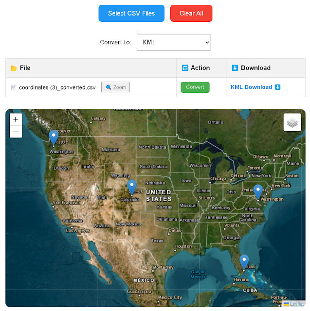
Upload and visualize CSV with coordinates, convert to GeoJSON, KML, GPX, Excel. Free, browser-based tool with map preview.
Need to preview your CSV coordinate data on a map before exporting to geospatial formats? Welcome to our powerful CSV to Geo Format + Map Converter — a browser-based solution that combines real-time map visualization with multi-format export (GeoJSON, KML, GPX, XLSX, and more). Ideal for GIS professionals, surveyors, students, and analysts who want to make sure their spatial data is accurate before downloading.
Supported Output Formats
This tool supports exporting your map-validated CSV to a wide range of formats used in GIS, navigation, and web mapping:
- GeoJSON – for web mapping platforms like Leaflet and Mapbox
- KML – for use with Google Earth
- GPX – for GPS devices and route planning
- Excel (.xlsx) – spreadsheet-ready with geographic rows
- TXT / ASCII / TSV – lightweight exports for plain text usage
- WKT, GML, XML – ideal for advanced GIS and metadata workflows
- TopoJSON / TileJSON / STAC JSON – specialized formats for tiled maps and spatial catalogs
Key Features
- 🗺️ Instant visualization of coordinates on a Leaflet-based map
- 🧭 Smart auto-detection of latitude and longitude fields
- 📁 Batch file support: Upload and process multiple CSV files
- 🔐 100% browser-based and private — no uploads, no tracking
- 💾 Direct download of converted files in your chosen format
Use Cases
This tool is perfect for:
- Researchers verifying geotagged observations from field work
- GIS students preparing assignments with accurate coordinates
- Real estate agents or marketers showcasing location-based data
- Data journalists visualizing public or environmental datasets
🔗 Related Tools on GeoJamal
- CSV to Geo Formats – No Map Version
- Fix and Clean Decimal Degree Coordinates
- Batch DMS to DD Converter
- Visualize DD Coordinates on a Map
📌 Frequently Asked Questions
| Question | Answer |
|---|---|
| Do I need to install anything? | No. Everything runs in your browser — no plugins, no accounts. |
| Can I export multiple formats? | Yes. You can export each uploaded file into any supported format individually. |
| What fields must be present? |
Your CSV should contain recognizable latitude and
longitude columns.
|
| Is my file uploaded to any server? | No. All processing is done locally in your browser for maximum privacy. |
🔎 Related searches: map CSV coordinates online — convert CSV to GeoJSON with map — preview latitude longitude from spreadsheet — export geotagged CSV to KML or GPX — free online CSV viewer with map


.jpeg)

